Sign at JMT junction
We hit the road not having decided what we were going to do. A week backpacking in the Sierra was fine no matter what, and we had plenty of time on the road to toss ideas around Do we want to go to the Bishop Pass area, loaf around and visit the lakes in every nook and cranny? Do we want to go over Lamarck Col and into the Evolution area? Do we want to go over Taboose Pass to Bench Lake and climb Arrow Peak?
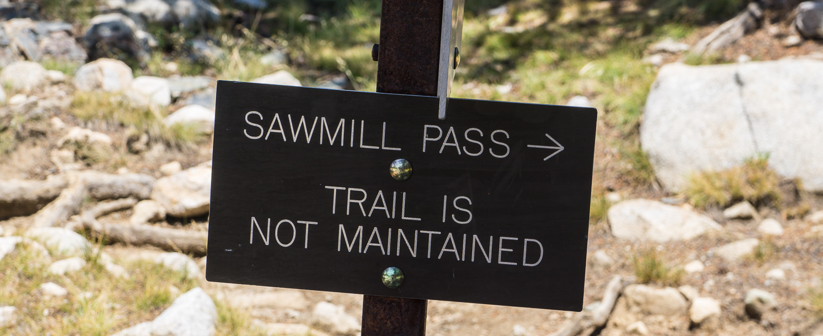
We started seeing smoke from fires in western California near Barstow and it got steadily worse as we headed north from Kramer Corners and up the Owens Valley. We began discussing alternate plans, such as driving to the ocean, spending a day on the beach and scuttling the whole trip. We stopped at the multi-agency center at Lone Pine and asked about a permit for Taboose Pass. To our utter amazement there was only one opening left, so that option is gone. We find out later that all the permits were taken by a group doing plant research in Upper Basin. We have no trouble getting a permit for the two of us to hike in via Sawmill Pass, so that will be the plan.
We have plans to meet some friends for dinner in Bishop, so we do something I have wanted to do for years, namely drive up Big Pine creek and see what it looks like. It looks like pretty much every other east side trailhead, but with some ammenities -- accomodations if you don't mind spending some money. After an hour or two here, we head to Bishop, meet our friends and have dinner at "Amigos", which is a nice Mexican restaurant, then it is off to a camp spot of ours east of town. A nice night camping at 7700 feet.
We make some final gear decisions. Most importantly, we decide to share one tent. Alex carries his REI Half Dome 2. He also carries his stove (a jetboil). I carry the gas can. This makes my starting pack weight 26 pounds, and his 29 pounds. He is 30 years younger than I am, and I am grateful that he is going out of his way to make my life a bit easier.
I am carrying a pack loaned to me by a friend. It is a Hyperlite 4400 "Porter" made from a fancy Dyneema fabric. I have gotten frustrated with sore shoulder muscles (trapezoids) when carrying even 25 pound loads with my current ultralight pack. I am hoping this new pack with a decent hipbelt and some structure will make things better (and it definitely does). Only 2.5 pounds -- very sturdy -- and virtually waterproof.
We get on the trail at 9:30 AM. Smart people would have started at sunrise given that the first several miles of the Sawmill trail are in hot desert with absolutely no shade or water and the temperature is going to hit over 100 degrees. The trailhead is at 4587 feet. It is hot, but we are from Tucson and fairly used to the heat. I carry only 1 liter of water, but a smart person would carry two. We don't push our pace to avoid generating excess heat (this sounds like an excuse, but actually is prudent for hot weather hiking). It is almost dangerously hot. We get to the stream thirsty and from then on, everything changes. We have a stream nearby, and trees overhead. It is tempting to stop at Sawmill Meadow, and that would make for a reasonable day, but we push on to Sawmill Lake, which made it a hard day.
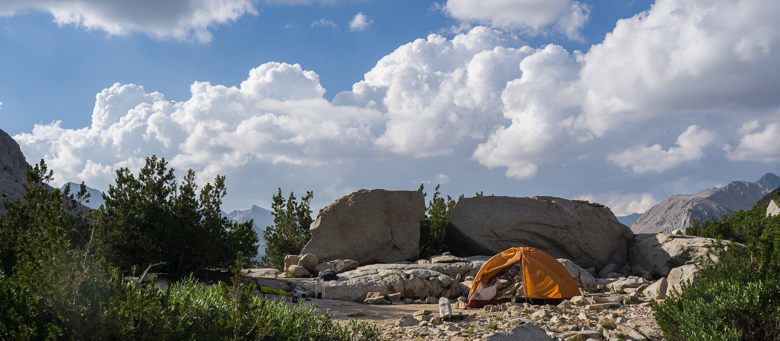
We got to Sawmill Lake just before sunset. We passed a party of 5 or 6 people down in the desert part of the trail (and never saw them again), and someone is camped at the lake. There are few campsites. We find a spot away from the other person among boulders towards the inlet side of the lake. The night is very warm (maybe 62 degrees). We hardly noticed the smoke unless we looked back towards Owens Valley.
We meet two people on their way out. They did an interesting loop via Window Creek and cross country to Bench Lake. Like what we are doing, but with some extra variety. Nice to see people doing interesting things in the backcountry.
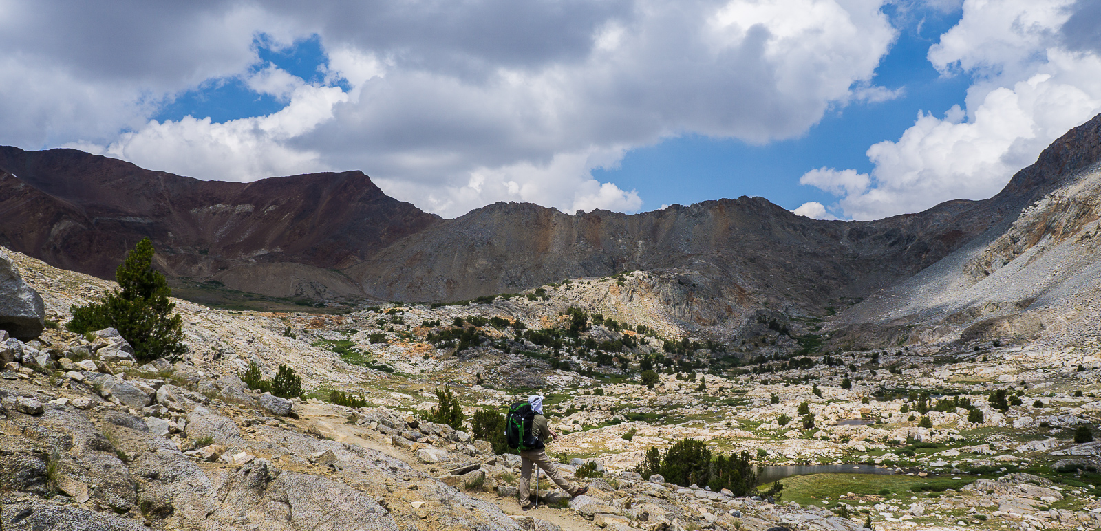
We are enjoying a lazy morning and find ourselves camped in a grove of foxtail pines (one of my favorite Sierra trees). There is plenty of Bush Chinquapin to enjoy and we see our first Clarks Nutcrackers. We are definitely in the Sierras! Up to Sawmill Pass we go and are at the pass by noon. Here we enter Kings Canyon Park. Clouds have built up and the sprinkles start as we stroll down from the pass. We are camped at the largest lake (Woods Lake) before 3:00 PM. This seems smart in light of the storms developing, and an easy day after pushing up Sawmill makes good sense. No big storm develops.
Clouds are building and the first drops begin to fall just after we cross the pass. I stop to pull out my rain jacket and fashion a rain skirt out of a black trash bag. None too soon as it turns out because the drops turn to a downpour and a vigorous hailstorm. Some hailstones are a half inch in diameter and hurt when they hit your head or bare hands! My rain jacket has seen better days and is not doing the job -- I will start shopping for a replacement when I get home. I get chilled and edge towards hypothermia. Alex is snug and fine in a fancy new Arcteryx jacket he is carrying. I am jealous. We look up at the peaks around us, and they are decorated by hail that has accumulated in chutes and on ledges. Lake Marjorie is beautiful, but we are somewhat distracted from the scenery by getting soaked. On the other hand, it is a novel experience and worth relishing.
The rain continues all the way to Bench Lake. We chat for a bit with a trail crew working on the spur trail to Bench Lake, then press on to a nice camp spot near the outlet to Bench Lake. We hurry to set the tent up, and the rain decides to give its last big spurt while we are doing this. That turns out to be the end of it and soon the sun is out and we are drying out gear. We have the place to ourselves! I had expected Bench Lake to be extremely popular, but apparently folks hiking the JMT don't want to make the detour of 2.4 miles each way. The skies clear and we have a pleasant night.
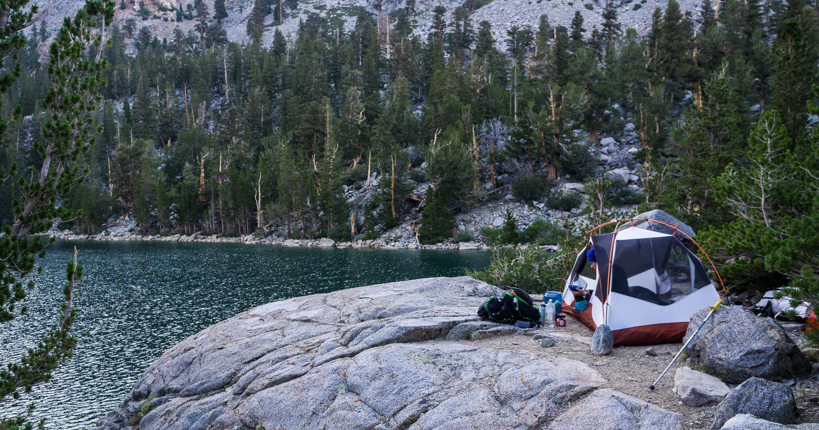
We explore a little along Bench Lake and check out the views north towards the South fork of the Kings river and Mount Ruskin. Then we pack up and head through nice forest back to the JMT. We chat again with the trail crew and are surprised and pleased to find Sam, the backcountry ranger at the Bench Lake station. We have a nice visit with him -- his "digs" consist of a huge canvas tent along with an outside area under a big tarp. It certainly looks like a great setup to me. We hike up to Lake Marjorie, which is spectacular. We stop early because clouds are building, but this is not any kind of disappointment. We have a fabulous camp spot among big rocks at the north end of the lake.
The storms fizzle, the sun comes out, and we take the opportunity to go for a swim in the lake. This season I have discovered that swimming in these high altitude lakes is great! Although it is really cold and you don't stay in long, it is wonderfully refreshing to jump in and get cleaned up a bit. You enjoy being clean afterwards, and with a sunny spot on a rock it is not at all uncomfortable to let the sun dry you off. This is true in July and August at any event, maybe not in September when the leaves start changing color.
We see only two other parties at the lake. One briefly camped next to us on the other side of our big rock, but then thought differently about it and vanished. The other was far away on the other side of the lake. By no means did we see anything resembling a "crowd of people" along the JMT.
The hike down turns out to be an effortless stroll with Alex and I talking the whole time. We shouldered packs at 9:00 AM and find ourselves at his truck at 2:20 PM.
We head to Lone Pine for a shower at the hostel and the now tradional pizza and drive to our camp spot west of Needles, getting there about 8:30 PM.
We are at our spot just after sunset and watch the stars come out. A nice night, albeit quite windy.
My camera on this trip was my Sony A6000 mirrorless, which I am unendingly pleased with for a backpacking camera. I use the 18-55 lens, which is fairly inexpensive, and to my taste delivers excellent results -- you can look at the photos and decide for yourself. I use it on a Peak Designs Capture Pro, which allows me to carry it on the left side strap of my pack. If it rains, it goes into a neoprene case and inside the pack. I have had one unpleasant incident with the Capture Pro. On a previous trip, the plate came unscrewed, dropped the camera and broke the lens. On this trip, I glued the tripod stud into the camera to avoid any more of that nonsense, and had no troubles whatsoever. You have been warned.
This was my first trip with a Hyperlite pack -- a friend loaned me his 4400 "porter". I could not have been more pleased. I have a list of things that I am excited about:
Food worked out perfectly. I was still enjoying some acclimatization from a trip the week before, so my appetite was up, and I had a couple of extra Ramen that I enjoyed. But my 1.3 pounds per day rule worked out perfectly. I was never hungry, nor did I find myself having to force food down. I made my exit with essentially no food left over -- perfect!
Tom's hiking pages / tom@mmto.org